1
/
of
1
mysite
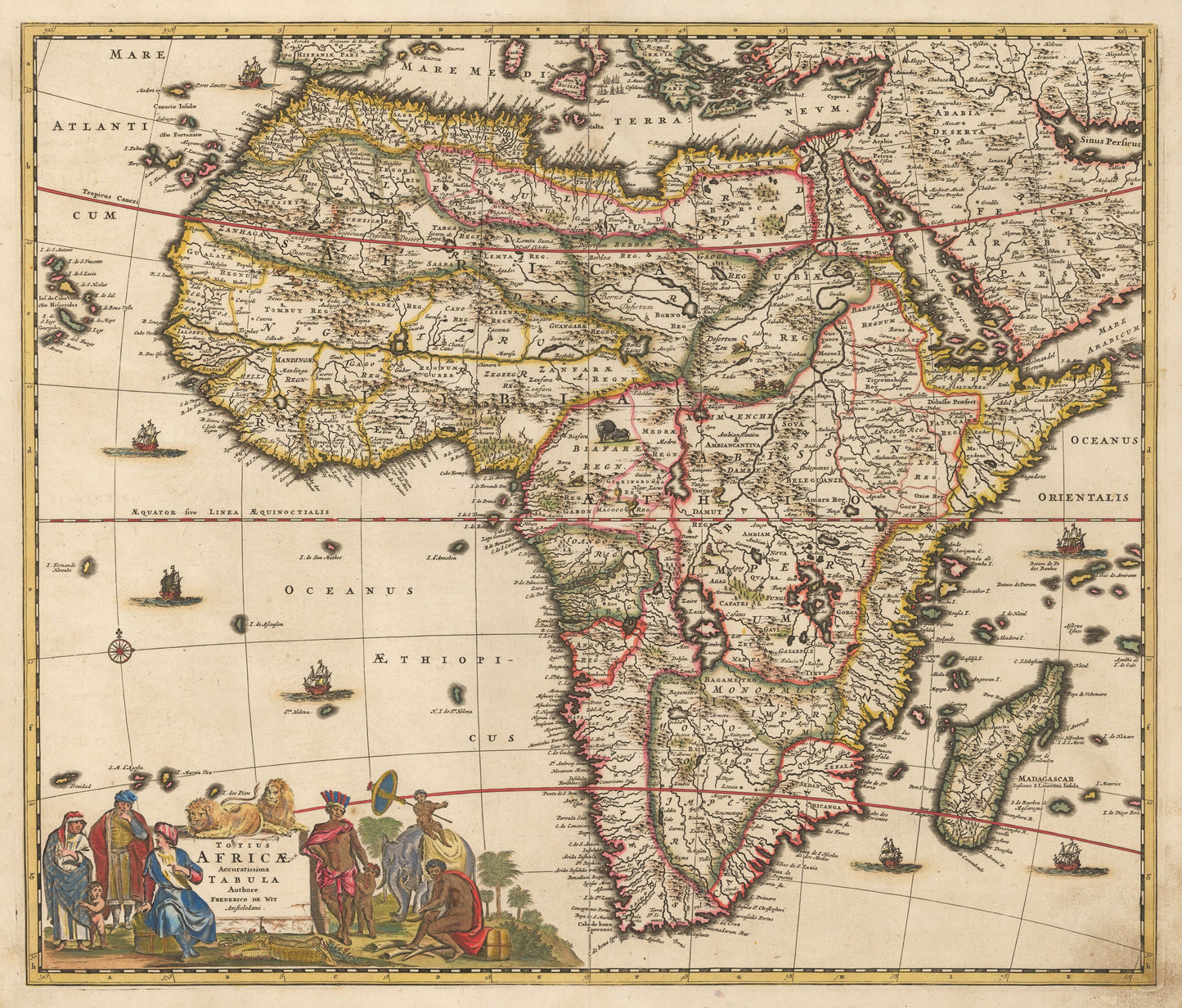
1689 Totius Africae Accuratissima Tabula
1689 Totius Africae Accuratissima Tabula
Regular price
£369.00 GBP
Regular price
£374.00 GBP
Sale price
£369.00 GBP
Taxes included.
Shipping calculated at checkout.
Quantity
Couldn't load pickup availability
By:?Frederick De Wit
Date: 1680 (published) Amsterdam
Original Size:?19.5 x 23 inches (49.5 x?58.5 cm)
This is a fine reproduction of an original, decorative map of Africa by Frederick De Wit that became the standard for many maps to came. Some notable geographical features include the Ptolemaic version of the source of the Nile (two large lakes) and the Niger River shown to dramatically cut straight through West Africa from its source Borno Lacus. Its true source is in the Guinea Highlands in southeastern Guinea and it runs northeast through Mali and then south through Nigeria finally discharging into the Gulf of Guinea in the Atlantic Ocean.
There is an elaborate title cartouche in the lower left quadrant which portrays European settlers trading goods for ivory with natives while an elephant and two lions observe in a peaceful manner. Numerous animal vignettes decorate the interior of the continent and the oceans are accented with sailing ships and a compass rose.
Inventory #50651
Share