mysite
1892 Rand, McNally & Co¡¯s. Indexed Atlas of the World Map of Australia
1892 Rand, McNally & Co¡¯s. Indexed Atlas of the World Map of Australia
Cena regularna
£289.00 GBP
Cena regularna
£15.00 GBP
Cena promocyjna
£289.00 GBP
Z wliczonymi podatkami.
Koszt wysyłki obliczony przy realizacji zakupu.
Ilość
Nie można załadować gotowości do odbioru
By: William H. Rand
Date: 1892 (Published) Boston
Original Size: 26 x 19.5 inches (66 cm x 50 cm)
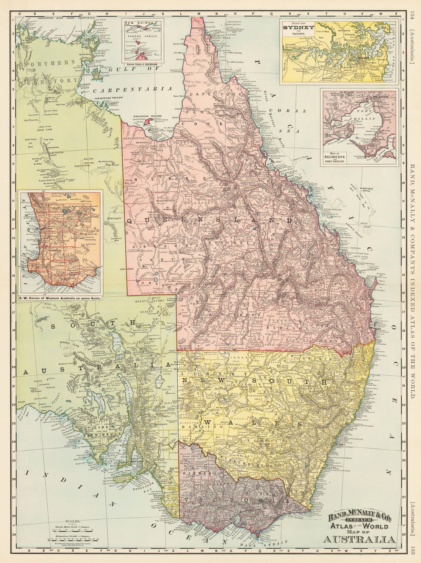
This is a reproduction of a vintage map by Rand McNally and Company of eastern Australia, which covers that half of the continent from Crocker Island to the Bass Strait. Though the map does not cover the entire continent, it does contain a wealth of information regarding the eastern regions along with one area in the southwest.
Four highly detailed insets are included. The two in the upper right quadrant show Sydney in one, where even a Cricket Ground is delineated, and Melbourne in the other, which includes mountains, cities, swamps, etc. A third inset shows a southern point of New Guinea and a northern tip of Australia, where the two nearly meet, and includes the various straits and islands between them. The fourth inset is similarly detailed, showing the SW corner of Western Australia, including the city of Perth and virtually all information of the area that was known at the time.
At the time the map was published Australia was part of the British Empire but the colonies managed most of their own affairs through the practice of responsible government. The map is color coded according to provinces and regions and shows cities, towns, rivers, streams, mountains and various other topographical features.
Inventory #19628
Share