mysite
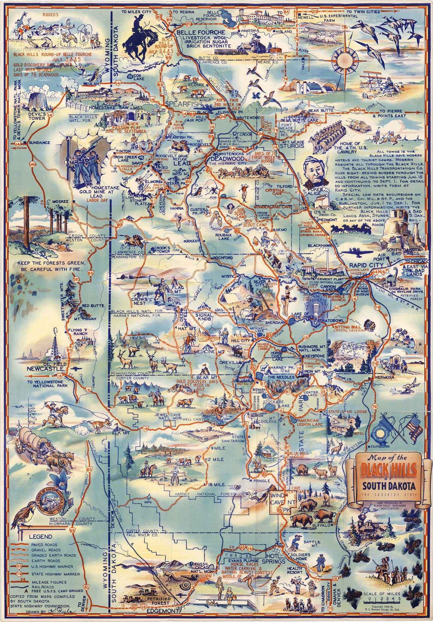
1940 Map of the Black Hills of South Dakota the Sunshine State
1940 Map of the Black Hills of South Dakota the Sunshine State
Impossible de charger la disponibilité du service de retrait
By: R. L. Bronson
Date: 1940 (copyright) Sturgis, S.D.
Original Size: 26 x 18 inches (66 cm x 44.7 cm)
This is fine reproduction of a whimsical pictorial map of the Black Hills region of South Dakota. It was originally produced to promote tourism throughout the area in the 1940s.
The Black Hills are a small, isolated mountain range rising from the Great Plains of North America in western South Dakota and extending into Wyoming. In the 18th century, the area was primarily occupied by the Lakota tribe of the Sioux Nation. In 1874 Brevet Major General George Armstrong Custer of the 7th US Cavalry led an expedition there and discovered gold in French Creek. Almost immediately, thousands of prospectors made their way to the region, spawning a gold rush from 1875 ¨C 1878 that populated the towns of Deadwood, Central City, and Lead.
This pictorial map displays all major and minor roads and highways as well as railroads throughout the region. Images focus on historical events, people, and places, as well as natural attractions, and more modern tourism opportunities. The map was produced by the Black Hills ¨C Bad Lands Association as noted under the banner style title cartouche.
Inventory #19310
Share