1
/
de
1
mysite
1949 Scenic and Historic Illinois
1949 Scenic and Historic Illinois
Prix habituel
£45.00 GBP
Prix habituel
£15.00 GBP
Prix promotionnel
£45.00 GBP
Taxes incluses.
Frais d'expédition calculés à l'étape de paiement.
Quantité
Impossible de charger la disponibilité du service de retrait
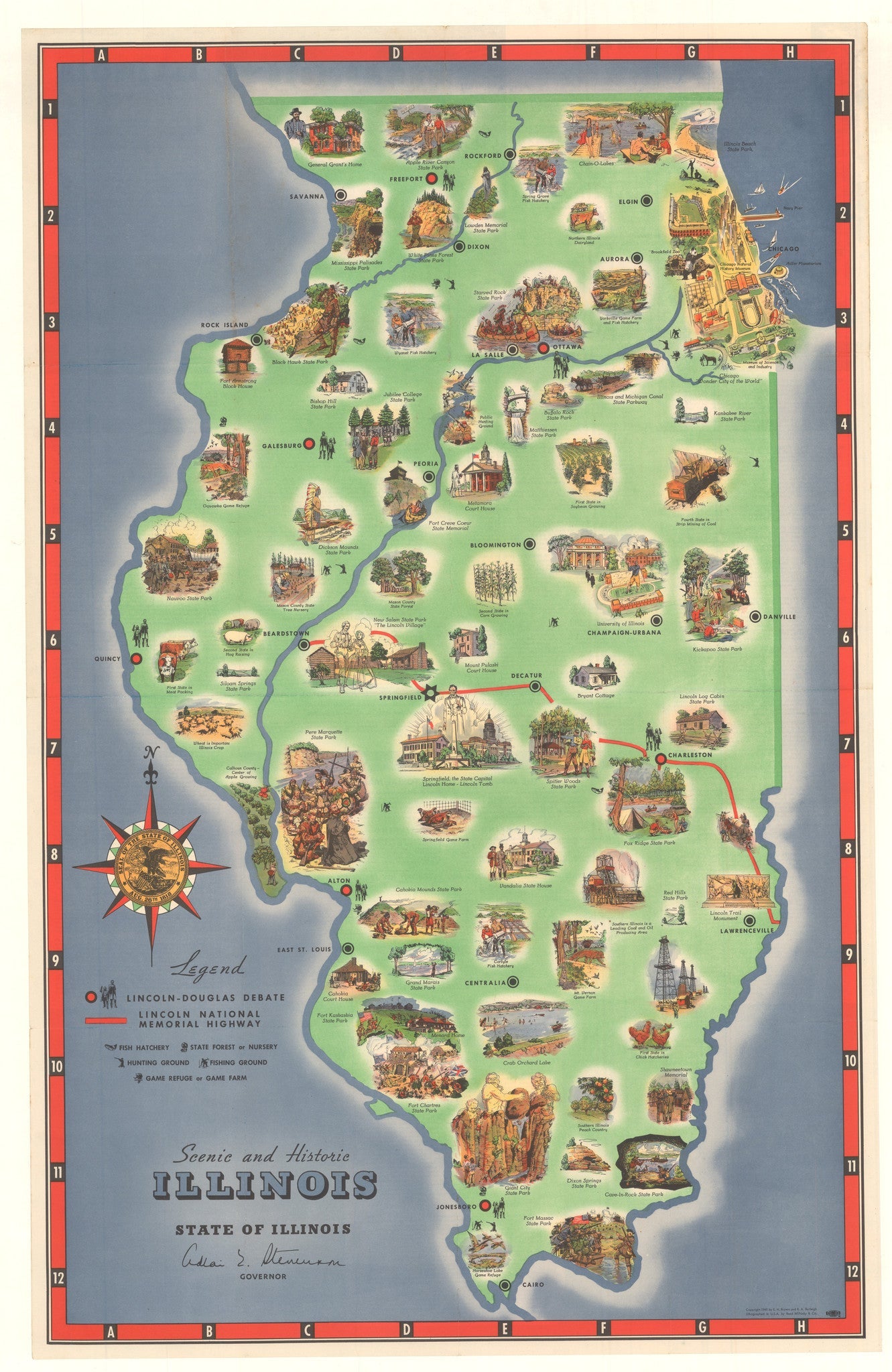
By: Rand McNally & Co.
Date: 1949 (Copyright) Chicago
Original Size: 33.5 x 21 inches (85 cm x 53.4 cm)
This is a fine print reproduction of a bold pictorial map of the state of Illinois detailing this history, natural beauty, agricultural achievements, and outdoor activities. The map was published by Rand McNally in 1949 when they were based in Chicago.
Special attention is paid to Abraham Lincoln as the map delineates the Lincoln National Memorial Highway, and each site of the famous Lincoln vs. Douglas debates of 1858. In Chicago, select landmarks are pictured in the style of a bird¡¯s eye view. Numerous vignettes illustrate the history, agriculture, and recreational opportunities of Illinois. Some such vignettes include the explorations of Marquette, the battle of Starved Rock, pictorial references to the livestock and farming industry, University of Illinois at Chanpagne-Urbana, vacationers at the Chain-O-Lakes, and various state parks. In the left-hand portion of the map is the seal of Illinois fills a sharp compass rose.
Inventory #19407
Share