mysite
1939 The City of New York
1939 The City of New York
Impossible de charger la disponibilité du service de retrait
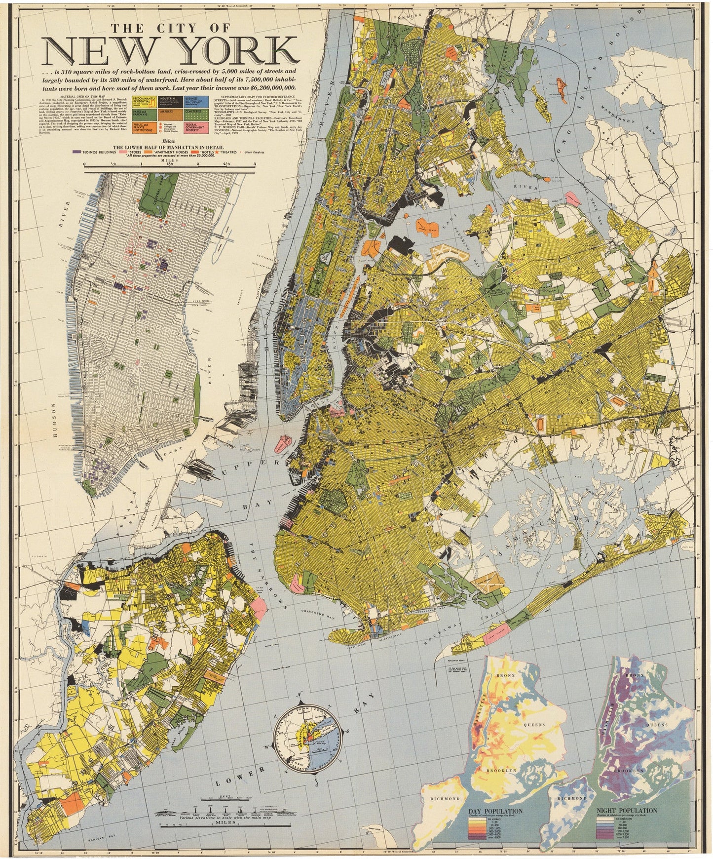
By: Richard Edes Harrison Date: 1939 (Published) New York
Date: 1939 (Published) New York
Original Size: 27 x 22 inches (68.6 cm x 55.9 cm)
This is a fine reproduction of an original color lithograph, designed by Richard Edes Harrison for an issue of Fortune Magazine in 1939.
The map centers on Brooklyn and Manhattan, but includes much of the surrounding burrows. The color-coded detail of the map is nothing short of an impressive work for its time. Residential areas, businesses, industry, cemeteries, airports, parks, institutions, and government property are all distinguished throughout the map. An insert below the title provides a more detailed street layout of lower Manhattan, from Central Park to Battery Park. In the lower right, an almost digital looking insert shows the difference between day and night population densities for the entire area shown in the main map.
This thematic map includes several references to the New York World¡¯s Fair/ It located fair grounds in Flushing, compares heights of landmarks such as the Empire State Building and Rockefeller Center with the Fair¡¯s Trylon and Perisphere.
Inventory #19630
Share