mysite
1675 Nautical Chart of the Mediterranean
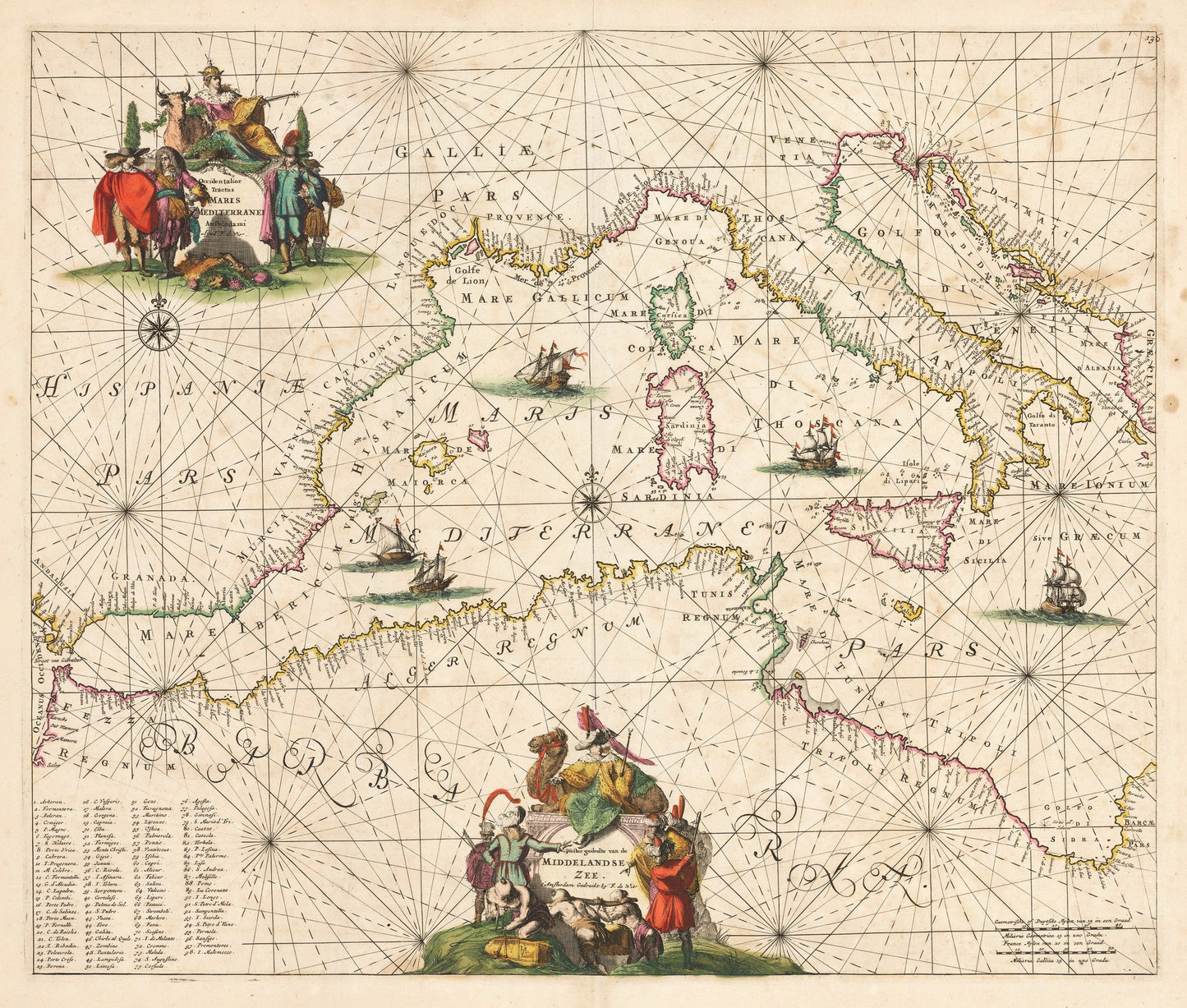
1675 Nautical Chart of the Mediterranean
Impossible de charger la disponibilité du service de retrait
Occidentalior Tractus Maris Mediterranei / Wester Gedeelte van de Middelandse Zee
By: Frederick De Wit
Date: 1675 (published) Amsterdam
Original Size: 18.5 x 22.25 inches (47 x 57.2 cm)
This is a superb reproduction of an elegant sea chart of the western Mediterranean extending from the Straits of Gibraltar to the Adriatic Sea. The map was published out of Amsterdam in 1675 by Fredrick de Wit as part of Orbis Maritimus ofte Zee Atlas.
As with most sea charts, numerous capes, coastal cities, ports, islands and navigational hazards are listed while the interior of both Europe and Africa are completely void of cartographic detail. Rhumb lines radiate from several compass roses throughout the map, providing a directional reference to ships at sea. Two ornate title cartouches adorn the interiors of Barbaria and Western Europe.
Inventory #19522
Share