1
/
von
1
mysite
1929 A Map of Old Boston in the Commonwealth of Massachusetts
1929 A Map of Old Boston in the Commonwealth of Massachusetts
Normaler Preis
£55.00 GBP
Normaler Preis
£15.00 GBP
Verkaufspreis
£55.00 GBP
Inkl. Steuern.
Versand wird beim Checkout berechnet
Anzahl
Verfügbarkeit für Abholungen konnte nicht geladen werden
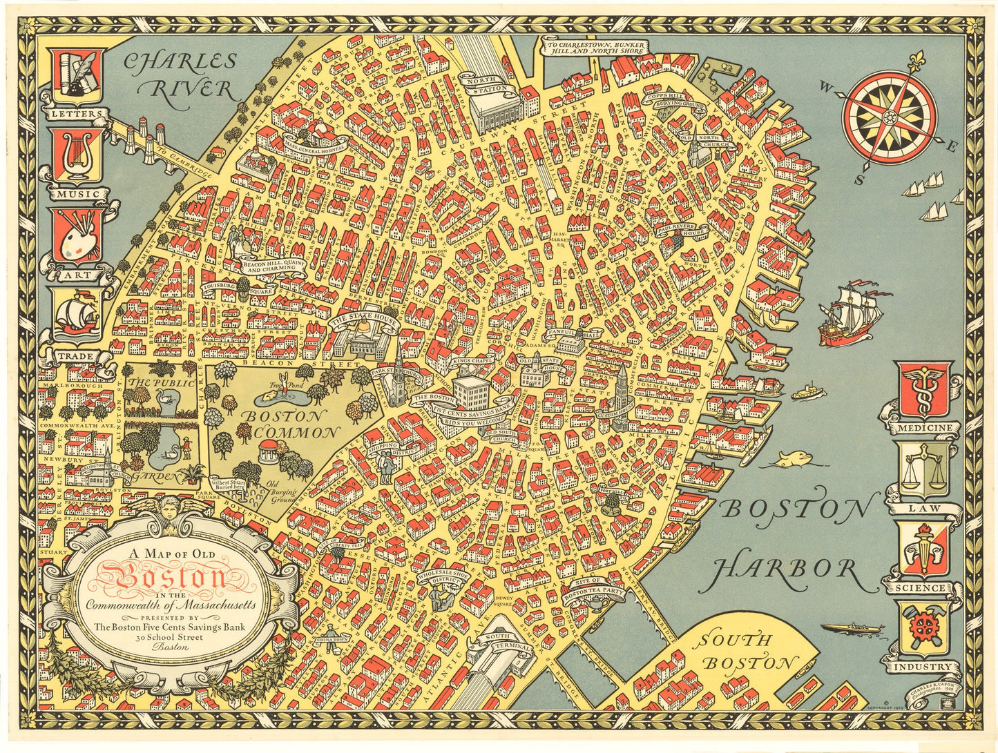
By: Charles R. Capron
Date: 1929 (Dated) Boston
Original Size: 18.25 x 24.5 inches (46.4 cm x 62.25 cm)
This is a reproduction of a lovely pictorial map of Boston Massachusetts. The map was made as promotional material by the Boston Five Cents Savings Bank located at 30 School Street in the center of the map.
Every street is noted and various landmarks, and districts are noted, including Chinatown, the Shopping District, the site of the Boston Tea Party, Paul Revere¡¯s house, the Old State House, and Beacon Hill, to name a few. Flanking the map are several coat-of-arms representing letters, music, art, trade, medicine, law, science, and industry. A compass rose, sailing and motor ships, and a whale ornament the Boston Harbor.
Inventory #19406
Share