mysite
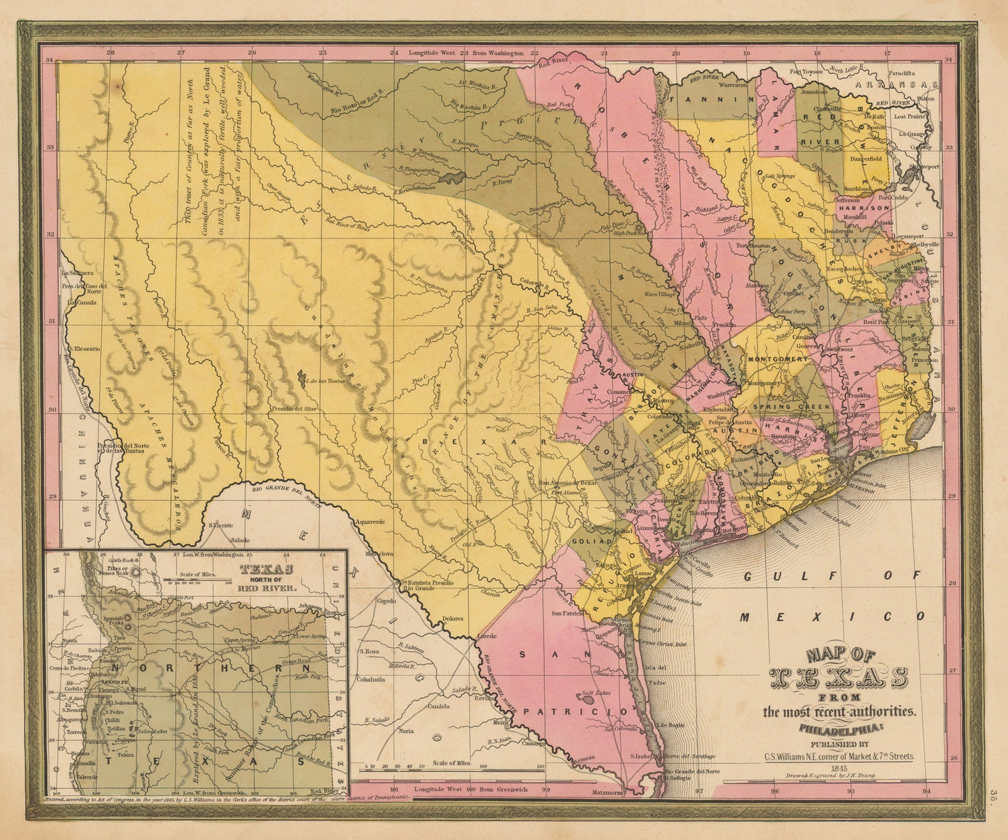
1845 Map of Texas from the most recent authorities
1845 Map of Texas from the most recent authorities
Verfügbarkeit für Abholungen konnte nicht geladen werden
Map of Texas as a Republic or Independent Country
By:?Henry Schenk Tanner
Date:?1845 (published) Philadelphia
Original Size:?15 x 12 inches (38 x 30.5 cm)
This is a vintage reproduction of a scarce authentic antique map, a fine example of Henry Schenk Tanner's rendering of the Republic of Texas, issued in Tanner's Universal Atlas shortly before Tanner sold the rights to the Atlas to SA Mitchell.
This reproduction is of the rare first state of Tanner's 1845 map of the Republic, which was changed shortly after publication to the second state which included county name changes, changes in size and additions of counties, the re-naming of Navasota County to Brazos County, the substantial shrinkage of Nacogdoches County, and the addition of Burnet County, along with the addition of a number of other counties.
The western part of the Republic is dominated by Bexar, Milam, Robertson and San Patricio Counties. Fort Alamo is shown, along with a few dozen other place names. About 15 early roads are shown. The large inset shows Texas North of the Red River. The Tanner editions of this map are quite scarce, and are often confused with Mitchell's 1846 issue (which is also dated 1845 on the map), but which can be distinguished by the difference in decorative borders.
Inventory #81019
Share